


Building of Trade Routes and Urban Growth
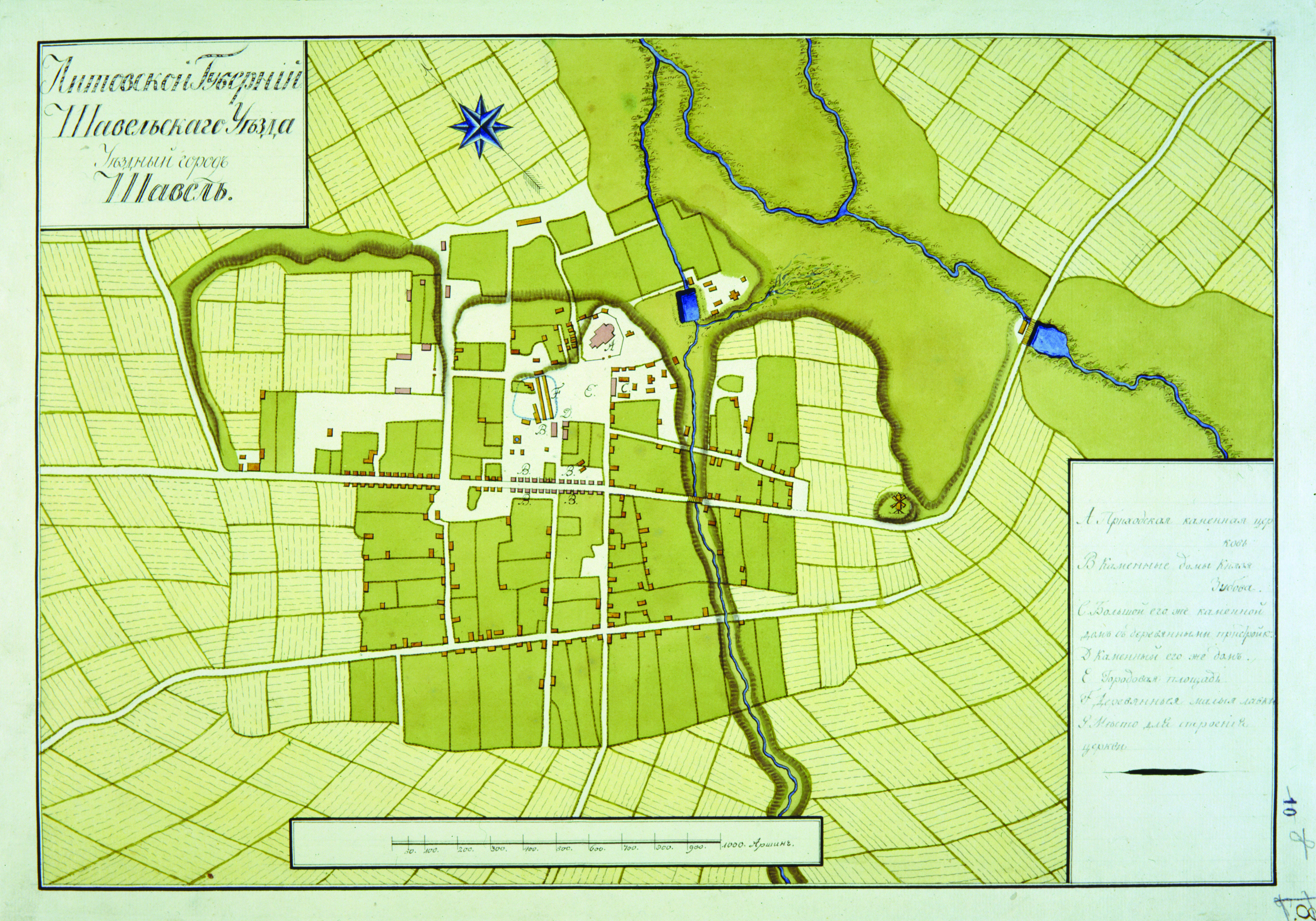
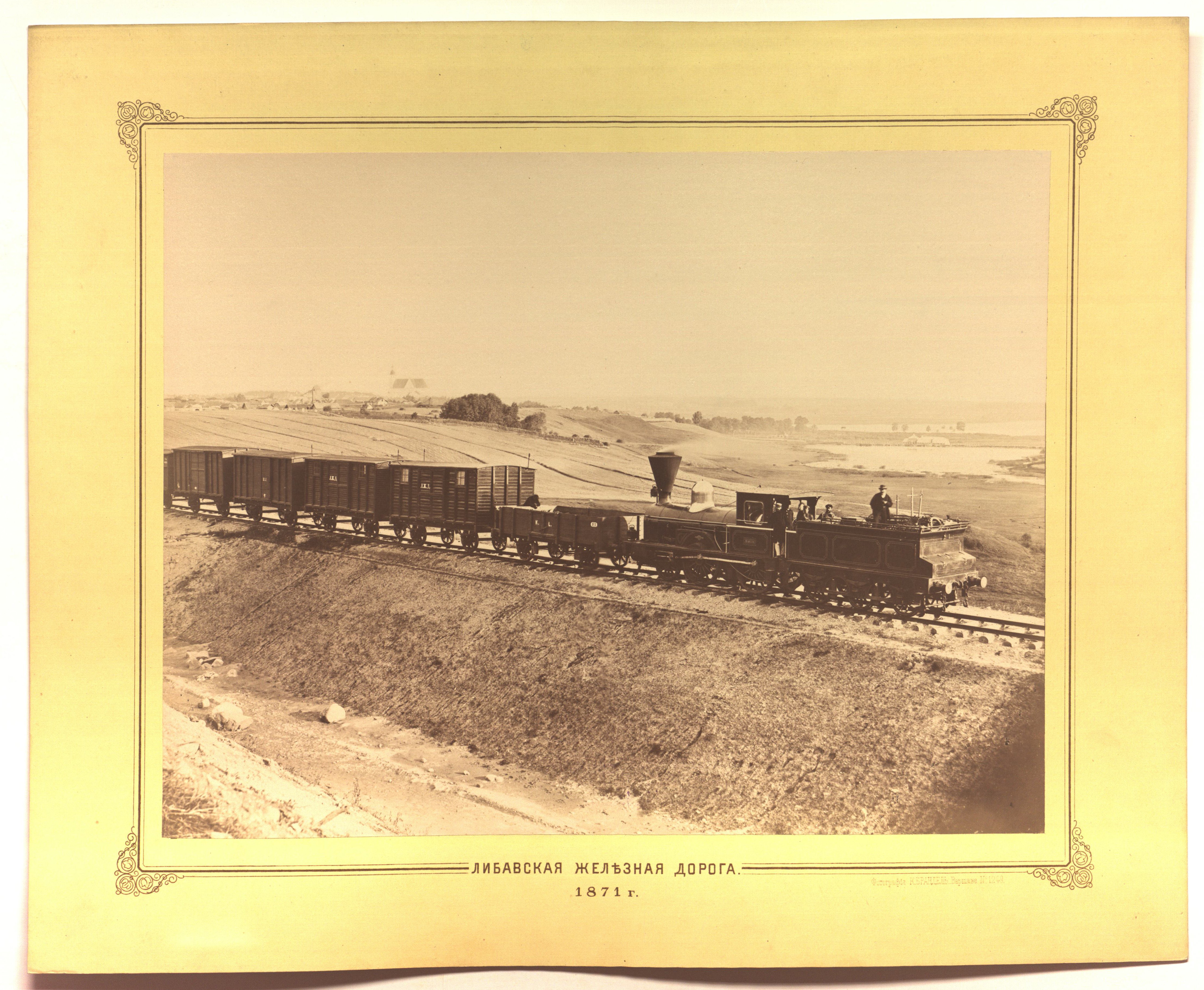
In the late 18th century and the early 19th century, the detailed picture of Šiauliai, recorded in the city plan drawn up in 1800-1801, is already known. It is the first city plan and one of the first such cartographic works in the history of Lithuania. This plan clearly shows the arrangement of buildings, streets and interurban roads of the growing city. Urban growth and economic development were directly influenced by trade routes. In the early 19th century, Šiauliai stood at the junction of post roads, one of which led as far as Palanga; another, to Panevėžys and further, already to Vilnius. Later, in 1835-1858, a very important highway from Riga to Tilžė via Šiauliai was built. Its significance grew even before it was completed – in 1853-1856, during the Crimean War, when all Baltic seaports were blocked. This in turn led to the economic revival of Šiauliai. The roads were used by post horses and private carriages of wealthy townspeople and civil servants. In 1825-1831, not far from Šiauliai, in the vicinities of the city (near the present settlements of Bubiai and Šaukėnai), the canal, known as Dubysos-Ventos perkasa, which was part of an ambitious project that had to join the Baltic Sea and the Black Sea, was dug. The construction of the canal was the largest work of this kind at that time in the entire Russian Empire. It was hoped to join the Nemunas basin with the Baltic Sea, because after the partition of the Commonwealth of Both Nations, the river mouth went to Prussia and the Russian Empire had to look for other ways to access the Baltic Sea. Construction works ceased due to the rebellion of 1831 and subsequent attempts to restart them were inefficient. In the long run, the importance of this canal declined when other transportation alternatives appeared. The Liepaja-Romnai railway line was opened (on September 4, 1871, the Kaišiadorys-Liepaja stretch, and on November 1, 1873, Radviliškis-Kalkūnai branch), connecting Šiauliai with important stations in Ukraine, Belarus, Latvia, and Russia. The earlier built Riga-Tauragė highway also has to be kept in mind; therefore, the growth of the city became unstoppable. Over 52 years (1861-1913), the population increased from almost 6 thousand to more than 23,5 thousand, which allowed Šiauliai to become the second most populous city of Kaunas province (guberniya). From 1861, the number of recorded 467 homes jumped to 1853 in 1910, of which 221 houses were already brick. At the turn of 18-19th centuries they started caring about planting greenery in the city, but only Didždvaris and the park established in it, which eventually became open to all inhabitants of the city, was famous for its exclusive green areas. On the other hand, there were enough green areas in the city, because plots with gardens were set up in many places.


Leave feedback